Geodata Germany 25.02
The database contain geodata of the Federal Republic of Germany with geo referenced towns, municipalities, town quarters, administrative units, postal codes, telephone preselections, nature areas, landscapes, climatic zones for proximity searches ec.
Product Specifications
| User Rating: |
Geodata Germany 24.08
4.5
out of 5
(based on 1 ratings)
|
|
| FileCart Rating | ||
| Submitted by: | xyxyxy | |
| Homepage | Visit Homepage | |
| License | Data Only | |
| Price | $175 | |
| Downloads | 455 | |
| OS Support | Windows Install Only | |
| File Name | geodatde.zip | |
| File Size | 3.16 MB ( 3,232 KB ) | |
| Published | Oct 20, 2006 (18 years ago) | |
| Updated | Feb 13, 2017 (7 years ago) | |
Follow Us!
Latest Searches
TRIANGULATION for IntelliCAD 1 hour ago
Net Monitor for Employees Pro 4 hours ago
Net Monitor for Employees Professional 4 hours ago
hitpaw photo enhancer coupon code 5 hours ago
2023 12 hours ago
elvis live counter 13 hours ago
GCulvert 19 hours ago
wise registry cleaner portable 1 day ago
2024 1 day ago
Popular Searches
Database Workbench Pro 258 times
TeraByte Drive Image Backup and Restore 255 times
Elcomsoft Phone Breaker 251 times
Elcomsoft Phone Viewer 232 times
Softperfect 230 times
SAM Broadcaster Cloud 223 times
BootIt Collection 223 times
YetiShare File Hosting Script 207 times
Antamedia HotSpot Software 205 times
Product Details
| Requirements: | All systems, only data |
| Release Info: | Major Update on Jun 09, 2021 |
| Release Notes: | All tables updated to the data status of 1 January 2021. Table LASTEN supplemented with snow loads >3 and >3a. DHDN coordinates in degree notation and Google Plus codes added. Formerly municipial free areas added and landscapes completed. Snow and wind loads and solar radiation from all locations. |
| Related Tags: | geodata cities towns municipalities postal codes |
Reviews
Reviews of Geodata Germany 25.02
You can be the first to write a review of Geodata Germany!Other products submitted by this publisher
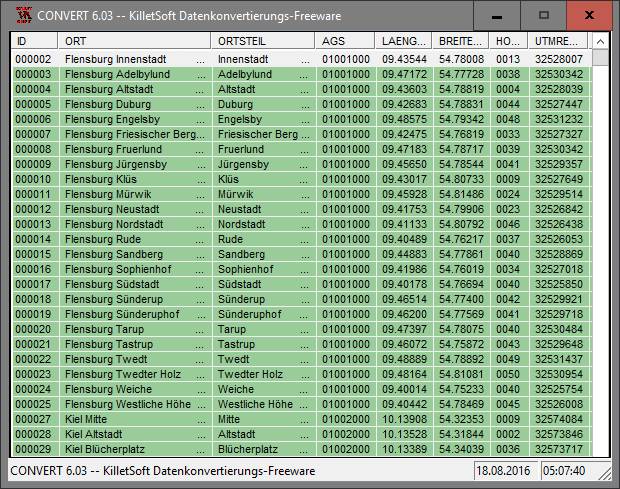
The freeware program CONVERT from KilletSoft converts databases and files between the dBase, CSV and SDF data formats and the character sets ANSI, ASCII, UTF8 and Unicode. Thus the import of the data in any DBMS will be possible.
DRAGSENSDRAGSENS Geo Software is used for the exact position estimation of a towed body, sensor, camera, array or net, dragged behind a ship, aircraft or vehicle. The software allows a real-time estimation of the position of a dragged sensor.
Geodata GermanyThe database contain geodata of the Federal Republic of Germany with geo referenced towns, municipalities, town quarters, administrative units, postal codes, telephone preselections, nature areas, landscapes, climatic zones for proximity searches ec.
Geodata GermanyThe database contain geodata of the Federal Republic of Germany with geo referenced towns, municipalities, town quarters, administrative units, postal codes, telephone preselections, nature areas, landscapes, climatic zones for proximity searches ec.
Geodata InternationalGeodata International - World-wide database of countries with georeferenced towns, municipalities, postal codes and administrative units with WGS84 and UTM coordinates and elevations for geocoding, proximity search, navigation, distance calculation.
Most Viewed Windows Database Tools
EMS SQL Manager for SQL Server 3.9
DBF Viewer 2000 6.55
DataNumen Access Repair 2.2
PHP DataGrid AJAX Enabled Web Control 8.2.7
Universal SQL Editor 1.9.2.2
Excel-Mysql converter 3.0
xBaseView Database Explorer 11.0
Data Loader 4.8
Altova MapForce Enterprise Edition 2017sp2